Hikes in Emilia-Romagna
The Emilia Romagna region embraces a great variety of landscapes, stretching from the east to west coast of Italy and from the river Po to the Apennines
A vast flatland with gently sloping hills and rocky peaks, you name it! Emilia Romagna offers a great variety of itineraries for outdoorsy people and nature lovers.
If you still haven’t got any plans for this summer and you’re passionate about hiking, here’s a list of hikes off the beaten track, to avoid the most crowded spots in the region! We’ve put together a good selection of some of the best hikes that you might be interested in, which differ in landscape, required fitness level and history.
Via Matildica del Volto Santo
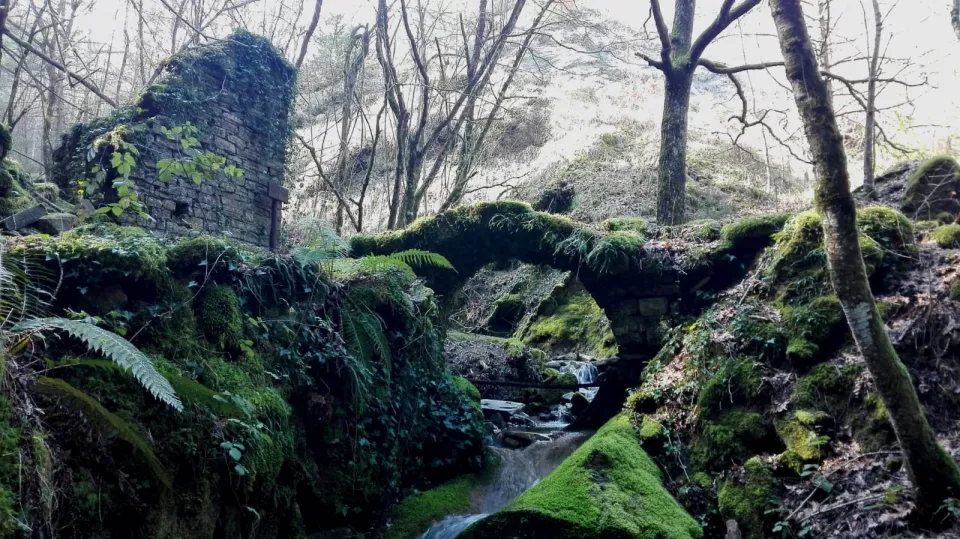
Have you ever heard of Matilda of Canossa? She was a long-lived grand duchess in the region. A symbol of female leadership that ruled over a vast empire during the XI century. Matilda's territories extend from Mantua to Lucca, which are the two extremes of the “Via Matildica del Volto Santo”.
Matilda was a very committed catholic and a great supporter of the Church. Her religious belief encouraged her to build around 100 churches across her empire, some of them still visible on this ancient walk. The “Via Matildica del Volto Santo” was traced as an ancient pathway for pilgrimage, this walk passes through the “Tuscan-Emilian Apennine Park”, offering dramatic landscapes, ancient villages and archaeological sites. With a total length of 283km and 11 stages, this walk passes across 3 regions and through gorgeous scenery.
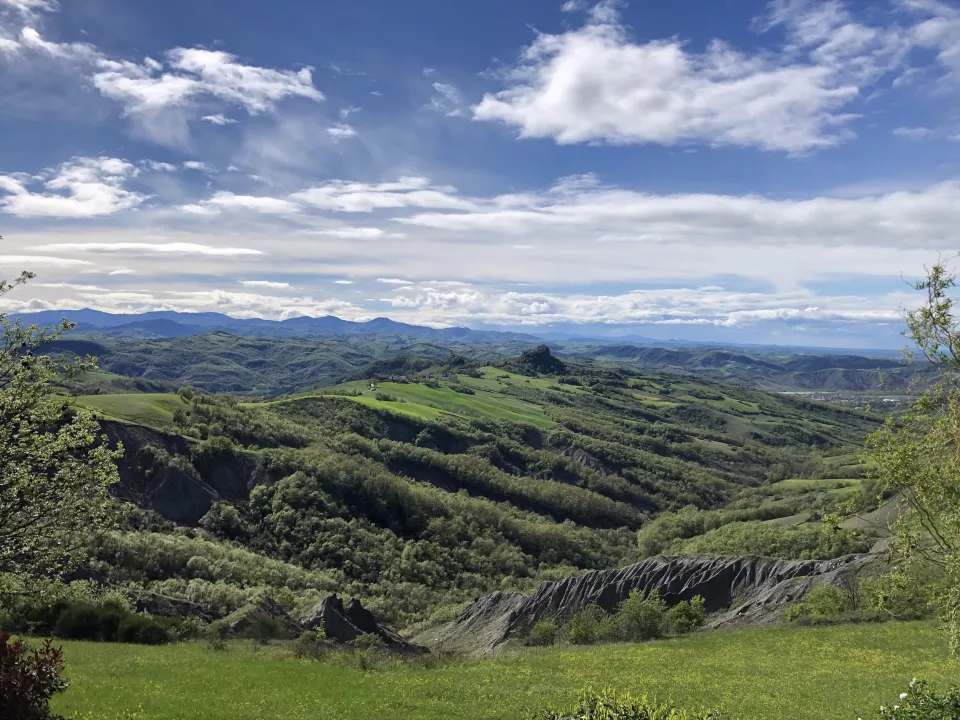
View of Canossa's valley in Reggio Emilia
Alta via dei parchi
If instead you prefer intense emotions and a challenge, and you’re quite fit, the “Alta via dei parchi” might be your perfect match. The approximately 672km path crosses eight National Natural Parks along the Apennine ridge. The walk starts in Berceto (Parma), close to the flourishing “Cento Laghi Park”, and in 27 stages it will bring you to the “Sasso Simoncello Park”, in the very eastern side of the Emilia-Romagna region, close to the borders with the regions of Tuscany and Marche. For the bike-lover, this magnificent itinerary can be covered in 28 stages. This walk follows path 00, traced by the Italian Alpine Club (C.A.I.), which follows the crests of the highest peaks in the region. Take a deep breath, because along this itinerary you’ll spot stunning scenery, facing the northern border of the whole Tuscan-Emilian Apennine National Park, and on the southern side, the region of Tuscany. If you’re lucky enough, on a clear day, you might even see the Apuane Alps and Elba island.
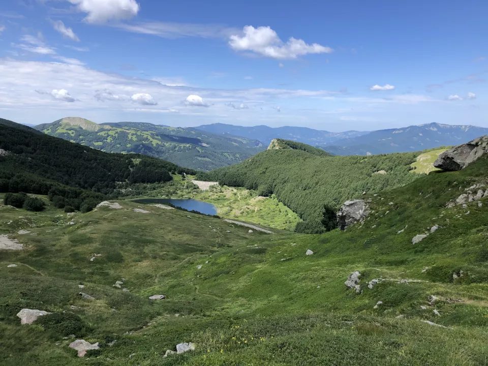
View of the "Cento Laghi Park" in Parma
Cammino dell’Unione
If you’re looking for something easier and more relaxing, you can walk along the “Cammino dell’Unione”. A ring path of 102km that’s divided into 5 different stages and passes through “Terre di Castelli”, a union of 8 municipalities nestled in the hills of Modena, well-known for their excellent farm-to-fork products and natural landscapes. This walk exudes the idea of slow tourism, discovering places and stories off the beaten track, all the while seasoned with the top product of the area, Lambrusco, the well-known red sparkling wine from Emilia.
This itinerary passes through many areas where several D.O.P. products are produced. Not only Lambrusco, but also the famous cherries from Vignola, one of the best Parmigiano Reggiano produced from the white-coated cows of Zocca and of course, Balsamic Vinegar. So, if you like hiking and discovering local flavours, then this walk is for you!
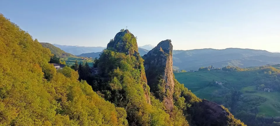
View of the "Sassi di Roccamalatina Park" in Modena
Sentieri Partigiani
Our region is well-known for its food and the automotive industry as well as for its high-quality welfare and lifestyle. However, it's also a land rich in both history and memories, a place where many crucial milestones of recent history have taken place. During WWII, in September 1943, Italy turned its back on Germany, creating quite a chaotic and dangerous political situation. Most of the German troops were still on Italian territory, meaning that they had to begin fighting against those who were allies just a few days before, as did the Italians. The Apennines became a natural battlefront. On the northern side, the remnants of the German army were the ruling force. In the south, American troops were liberating the country step by step.
Between these two factions, the “Partigiani”, an autonomous group of local rebels, start fighting with their only goal being to release Italy from the enemy's grip. Most of these fighters were civilians, farmers and activists, who were very experienced in the Apennine territory. The routes for these walks are the paths that the Partigiani traced during the battles and ambushes against the Germans, and are still visible and walkable today. These walks, which spread across Reggio Emilia’s Apennines and are called the “Sentieri Partigiani”, form part of the cultural heritage and represent the historical memory of this territory, as well as that of the entire nation.
Strabatenza hike in the "Foreste Casentinesi Park"
Beyond the listed itineraries there are many more across the region, and we invite you to discover them all for appreciating the rich diversity of landscapes within the Emilia Romagna.
Do you have any suggestion or itinerary that you would like to share?